Wildfire update
by Pinedale Online!
August 21, 2011
The majority of the large fire activity remains in the southern states.
Current large wildfires are burning:
California (1)
Colorado (1)
Idaho (2)
Montana (2)
Nevada (1)
Oklahoma (2)
Oregon (1)
Tennessee (1)
Texas (3)
Utah (1)
Virginia (2)
Washington (1)
Wyoming (1)
Year to date statistics: Fires: 48,893, Acres: 6,518,265
National Interagency Fire Center (NIFC) National Fire News: http://www.nifc.gov/fireInfo/nfn.htm
Bridger-Teton National Forest
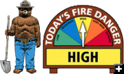
Fire Danger on the Bridger-Teton National Forest is HIGH. There is one active wildfire burning on the Bridger-Teton National Forest at this time. No Restrictions are in effect at this time.
The Red Rock Fire is burning on the Bridger-Teton National Forest approximately 26-miles northeast of Jackson and has burned nearly 100 acres. The fire was discovered Saturday, August 20 and was determined to have been ignited by lightning. Burning in mixed conifer trees, the fire is located ľ-mile east of the Crystal Creek trailhead near Alkali Creek. This fire is being allowed to burn to benefit the resource.
Click here for 2011 Bridger-Teton National Forest wildland fire information: http://gacc.nifc.gov/egbc/dispatch/wy-tdc/wildland-fires.html
Bridger-Teton National Forest fire news: http://www.tetonfires.com
Please Be Careful With Fire! On Thursday, August 18, the Teton Interagency Fire managers raised the fire danger to high. With high fire danger, all fine dead fuels spread readily and fires start easily from most causes. Unattended brush and campfires are likely to escape. Fires spread rapidly and high-intensity burning may develop on slopes or in concentrations of fine fuels. Fires may become serious and their control difficult.
Successful management requires prevention of human-caused fires and initial attack on fires in suppression zones. Lightning-caused fires may be assessed for a full spectrum of management responses. Most of Wyoming's counties have year-round restrictions regarding fireworks, burning notifications, etc. Please contact specific counties for information regarding any year-round restrictions.
Open areas are visibly curing. Though shaded areas appear green, they often shelter dried fuels. Unattended or abandoned campfires can easily escalate into wildfires. It is important that all campfires are completely extinguished and cold to the touch before leaving a site. Campers and day users should never leave a fire unattended, and should always be prepared by having a water bucket and shovel on hand and ready for use.
As of August 16, there have been 52 abandoned or unattended campfires discovered on the Bridger-Teton National Forest and Grand Teton National Park.
Teton Interagency Dispatch Center
The Teton Interagency Dispatch Center is located in Moose, Wyoming. It is an all-risk dispatch management and resource mobilization unit in western Wyoming.
The dispatch center serves Bridger-Teton National Forest, Grand Teton National Park, and John D. Rockefeller, Jr. Memorial Parkway. as well as wildland fire and prescribed fire activities for the U.S. Fish & Wildlife Service (National Elk Refuge), Wyoming State Forestry (Teton Zone), and County Fire Services for Teton and Sublette counties and the northern portion of Lincoln County.
The Fire and Aviation Management programs within the Bridger-Teton National Forest and Grand Teton National Park are integrated to provide a professional and innovative interagency fire program. While they are the primary players in Teton Interagency Fire, they work closely with the National Elk Refuge, Wyoming State Forestry, and Teton, Lincoln and Sublette counties. Cooperation is key, not only during fires, but during all aspects of fire management, from the training and planning through responding to an incident.
Wyoming
Norton Point Fire – 15, 915 acres
This fire is located twenty-four miles north of Dubois, Wyoming on the Shoshone National Forest. It is north of the Double Cabin Campground and Guard Station. This wildfire was started by lightning on Friday, July 22nd. It is burning in conifer forest with beetle-killed standing trees and fallen timber. Terrain is rated difficult. It is currently in patrol status with 5 people monitoring the interior residual fire burning. This fire has moderate potential for growth. The last report was for Thursday, August 18th, which was the last official report unless significant activity is reported. At that time the Norton Point Fire was experiencing active fire behavior and grew around 735 acres. As of Friday, August 19th, the fire size was 15,915 acres. The Norton Point Fire Closure is being increased to the east and to the south. After about a week of inactivity dead trees in the Bug Creek area combined with dry warm winds created conditions for an increase in fire activity. The increase in fire activity on Friday, August 19th, made for a large smoke plume, mostly associated with the Bug Creek drainage, although firefighters monitoring the growth reported that along with Bug Creek, some interior islands in the Caldwell drainage were actively burning too, along with minimal activity on the south end of the fire in Division Z. More info on Norton Point fire in Wyoming: http://www.inciweb.org/incident/2427/
Natrona County fire crews are battling a 200 acre blaze at the south end of the Big Horn Mountains. The fire was first reported on Wednesday afternoon, August 17, and is burning in rugged terrain 87 miles northwest of Casper. No homes or other buildings are threatened at this time. Numerous brush trucks and water tenders are on the scene as well as three 20 person hand crews.
Crews are also fighting 200 acre fire in Sweetwater County about 45 miles south of Rock Springs. The Brooks Wildfire was estimated to be 60% contained as on the Friday, August 19 Bureau of Land Management update. Full containment was expected early on Saturday, August 20. The wildfire has burned approximately 291 acres, including 89 acres on private land, and continues to smolder and creep with occasional internal single-tree torching. Eight engines from the Bureau of Land Management High Desert District and Sweetwater County, one helicopter and the Rogue River Hot Shots from Oregon’s Rogue River-Siskiyou National Forest are on the incident. A map of the wildfire is available at
http://www.blm.gov/wy/st/en/info/news_room/2011/august/19hdd-brooks.html.
Idaho
All Boise BLM fires are now contained. As of Thursday, August 18, all wildfires from the weekend's lightning storm have been contained. In total, nearly 137,000 acres have burned since Sunday, August 14th. On August 18th, fire resources will be demobilized off all of the fires with the exception of the Blair Fire. An estimated control time for that fire has been set for Saturday, August 20.
Resources from across Southern Idaho and from neighboring states were assisting the Boise District with the multiple wildfires. At the height of fire activity, approximately five hundred fifty firefighters were on scene. Having consistent pre-season training requirements allows outside resources to seamlessly plug into any ongoing wildfires.
More info: http://www.inciweb.org/incident/2474/
Texas
Texas is currently battling its worst fire season in state history. Texas Forest Service and local firefighters have responded to 18,913 fires that have burned a record-setting 3,455,124 acres since fire season began on November 15, 2010.
Six of the state's largest wildfires occurred in April 2011.
Texas Initial Attack crews and equipment are pre-positioned throughout the state to assist local fire departments with wildfire suppression actions when requested. The State Incident Command Post is located in Merkel, 20 miles west of Abilene.
Hot and dry conditions are predicted to persist at least until early fall, unless relief is provided by tropical storms or hurricanes. On August 18, the National Weather Service Climate Prediction Center released its updated U.S. Seasonal Drought Outlook through November. The drought is expected to continue or persist across the entire state. Currently, 78 percent of the state is in exceptional drought, the highest drought category.
Currently, all but four of the state's 254 counties have burn bans. More than 2,500 structures, including 662 homes, have been confirmed lost.
More on Texas wildfires: http://www.inciweb.org/incident/2315/
|